Mount Ol doinyo Lengai Overview
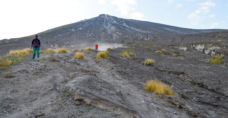
Known by the Maasai people as the "Mountain of God", Ol Doinyo Lengai is nothing short of spectacular. Rising majestically from the Great Rift Valley floor to a height of 2890m, Ol Doinyo Lengai is the only active volcano on planet that erupts carbonatite lava. This type of lava is very unique because temperatures of these lavas are only around 500°C, about half the temperature of normal basalt lavas, and its lava flows with a viscosity almost as fluid as water.Described by others as a scientifically precious, geochemical shrine, Oldoinyo lengai's is quite a physically demanding climb. Its steep slope makes it a challenge to climb up as well as to climb back down and the day time heat is unbearable. The best time to climb the mountain is at night when the temperatures are lower. This allows the climber to witness the amazing sunrise at the summit and come back down before the scorching heat kicks in.Given the long transfer distance, it is best to trek Ol Doinyo Lengai as part of a 3 day tour. Below is a standard 3 day itinerary for Ol Doinyo Lengai but keep in mind this climb can be an addition to a longer safari tour depending on your preference.
South of Lake Natron in the eastern rift valley of North Tanzania, lies Mount Ol Doinyo Lengai (locally regarded as the sacred Mountain of God in the Maa Language), an active volcano. At 2878meters, Mt. Ol Doinyo Lengai is the only known volcano in the world that sometimes erupts natrocarbonatite lava, a highly fluid lava that contains almost no silicon. Natrocarbonatite lava (most fluid lava) is also much cooler than other lavas. During the day most of this lava flows look like fluid black oil. Some feel the lava flows resemble mud like-flows. Natrocarbonatite lava turns white when in contact with moisture. During rainy periods, the lava turns white almost immediately whilst this whitening takes longer during the dry periods.Mount Ol Doinyo Lengai also has phases of explosive activity during which the composition of the lava may contain much more silicate material. With this type of eruption, initial phases of the eruption may include strong lava fountains but usually there is no fluid lava and ash eruptions accompanied by ejection of rocks and explosions occurs. The two most recent eruptions of this type occurred during 1966-1967 and 2007-2008. Almost without fail, about every seven years Ol doinyo Lengai erupts and plumes of smoke billow out of the crater. At other times it is possible to walk down into the crater, almost to the edge of the molten lava flows.Views in the north from its summit crater lies the hot barren salt flats of Lake Natron stretch into the distance, beyond lies the Kenyan border. The day temperatures by the lake often exceed 40°C and a few animals survive here with the flamingo making its home here as breeding grounds, nesting on the salty surface on upraised mounds. The view on the east is dominated by Mt Kilimanjaro and to the west the forested escarpments and hills comprising the western slopes of the Great African Rift Valley. To the south stretches the Crater Highlands, Ngorongoro being one of the prime wildlife conservation areas in Africa. The ascent of Ol doinyo Lengai is demanding on account of the day time heat, lack of water, steep and unstable slopes of ash and crumbly rocks. An early start is recommended and the best approach is from the west where the morning sun can be avoided for a while.
3 Day